Tropical Depression #10 – September 17, 2019
Tropical Depression Ten Discussion Number 1
NWS National Hurricane Center Miami FL AL102019
1100 AM AST Tue Sep 17 2019
Deep convection associated with the area of low pressure over the
central Atlantic has become more persistent and better organized
this morning. Data T-numbers from both SAB and TAFB are 2.0 on the
Dvorak scale, therefore advisories are being initiated on a tropical
depression. The initial intensity is set at 30 kt, in line with the
satellite estimates. The depression is forecast to move over
gradually increasing sea surface temperatures within a favorable
upper-level environment. The only negative factor for
intensification appears to be some nearby dry air, but with low
shear conditions expected, so steady strengthening is forecast
during the next several days. The NHC forecast calls for the
depression to become a tropical storm later today, and attain
hurricane status within 72 hours. The NHC intensity forecast is in
good agreement with the SHIPS and LGEM statistical models.
Since the depression is still in the development phase, the initial
motion is a somewhat uncertain 295/10 kt. A strong deep-layer
ridge to the north of the cyclone should steer the depression
generally west-northwestward at a faster forward speed during the
next few days. The track guidance is in relatively good agreement
through 72 hours, and brings the cyclone near the northern Leeward
Islands in about 3 days. By late in the period, the cyclone is
expected to reach the western periphery of the ridge, and there is
increasing spread among the guidance. The global model ensemble
means are along the right side of the envelope while the HWRF and
UKMET are along the left side. The NHC track lies close the
consensus aids, which is also in good agreement with the latest
ECMWF.
Interests in the northern Leeward Islands should monitor the
progress of this system.
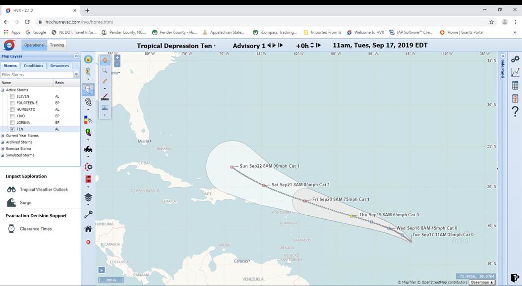
FORECAST POSITIONS AND MAX WINDS
INIT 17/1500Z 12.9N 44.9W 30 KT 35 MPH
12H 18/0000Z 13.8N 46.1W 35 KT 40 MPH
24H 18/1200Z 14.7N 47.9W 40 KT 45 MPH
36H 19/0000Z 15.5N 50.2W 45 KT 50 MPH
48H 19/1200Z 16.3N 52.9W 55 KT 65 MPH
72H 20/1200Z 18.2N 59.2W 65 KT 75 MPH
96H 21/1200Z 20.2N 64.7W 75 KT 85 MPH
120H 22/1200Z 22.5N 69.0W 80 KT 90 MPH