Tropical Weather Update – September 13, 2019
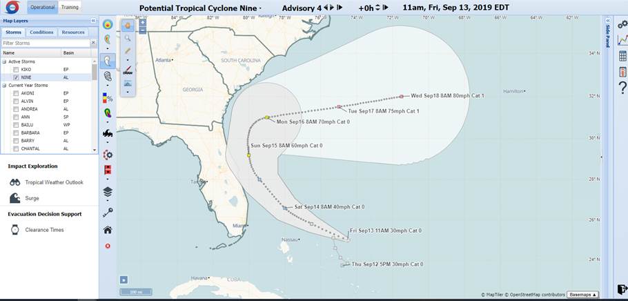
Potential Tropical Cyclone Nine Discussion Number 4
NWS National Hurricane Center Miami FL AL092019
1100 AM EDT Fri Sep 13 2019
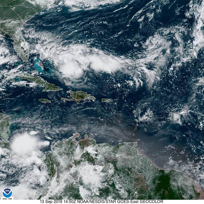
Preliminary data from a reconnaissance plane indicate that the
disturbance has not developed a well-defined center yet and
continues to be characterized by an elongated SW to NE trough of low
pressure. Satellite images however, suggest that the system could
be consolidating a little bit farther to the east within the area of
deep convection. The reconnaissance plane will also check this
region soon. In this advisory, the initial position is a point near
the middle of of the trough, but not quite as far east as the
convective area. The initial intensity remains 25 kt.
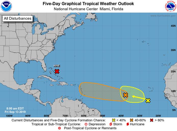
The disturbance is embedded within a moderate shear environment, but
this parameter is not expected to be strong enough to halt
development. The NHC forecast still calls for this system to
become a tropical cyclone later today or Saturday. Global models
develop the system and guidance suggests that the cyclone could even
reach hurricane intensity by the end of the forecast period. By
then, the system is expected to be over the Atlantic well southeast
of the coast of the Carolinas.
Due to a lack of a well-defined center, the initial motion is highly
uncertain. It appears that there has been little motion during
the past few hours. A weakness in the ridge over the western
Atlantic is forecast to develop and this pattern should steer the
system slowly toward the northwest and then northward. In about 3
days, an eastward moving mid-latitude trough will force the system
to recurve away from the coast toward the Atlantic. The guidance
has shifted a little to east this morning and consequently the NHC
track forecast was adjusted in that direction. However, the official
forecast is still on the western edge of the guidance envelope. If
the disturbance develops a little more to the east, the track
forecast will probably adjusted to the right later tod