Tropical Update – Thursday, September 6, 2018
To All,
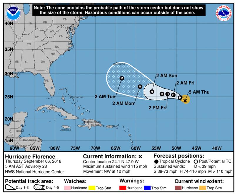
The Five Tropical Outlook has put a lot of red on the map for us to watch. As I have said earlier, we need to watch Hurricane Florence closely. By Monday, the east coast could be very interesting to see if we are in the in the error cone, or even closer. If we are, just be prepared for any protective actions.
The last graphic give the 3 and 5 day error cone.
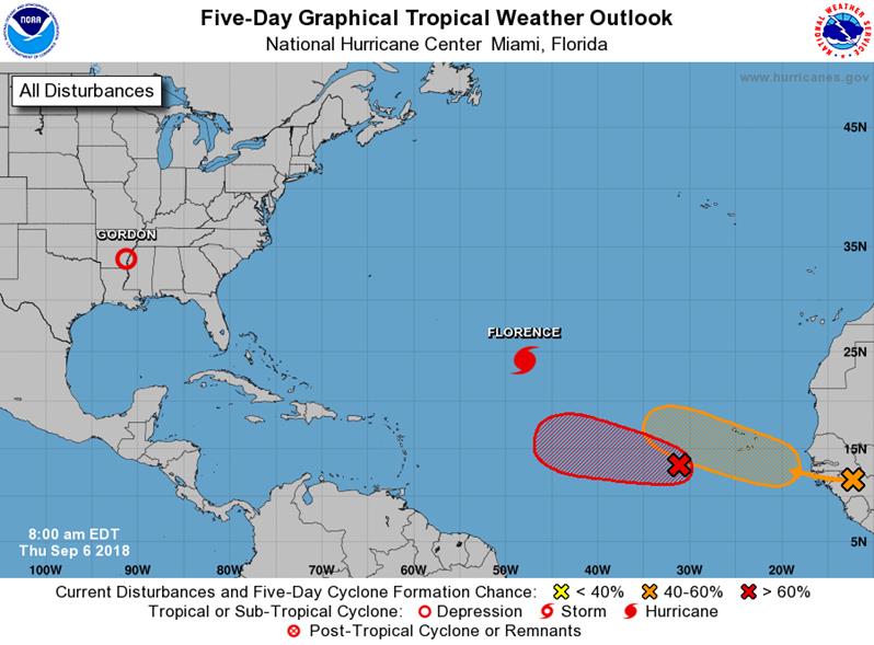
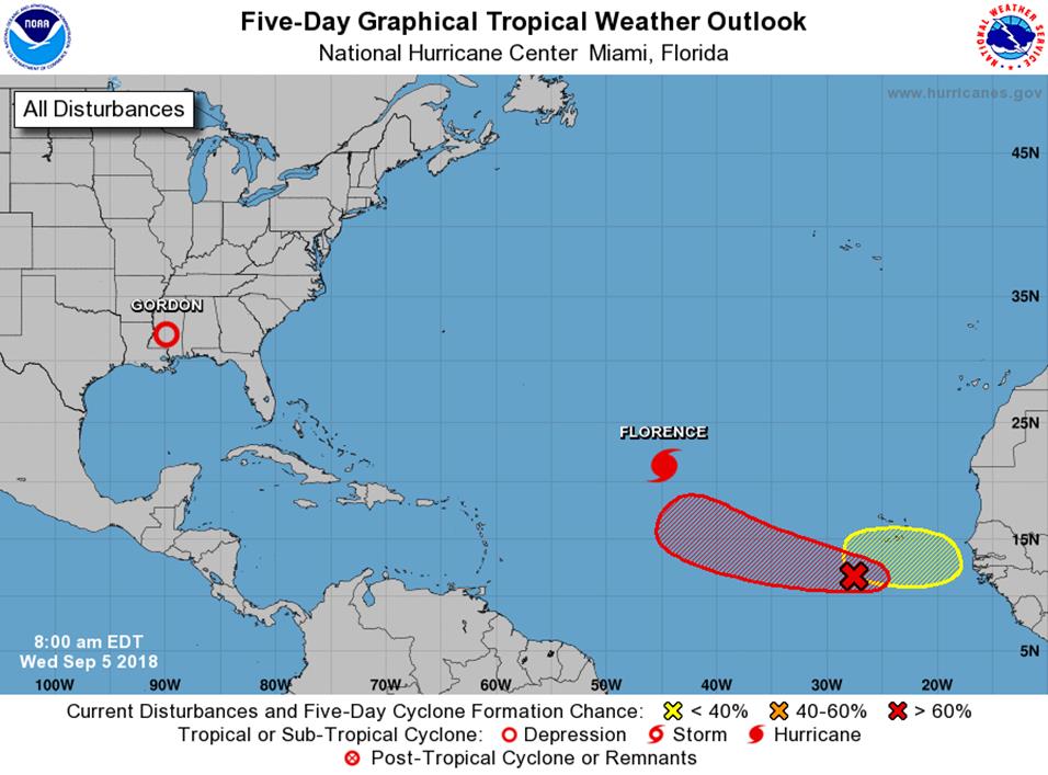
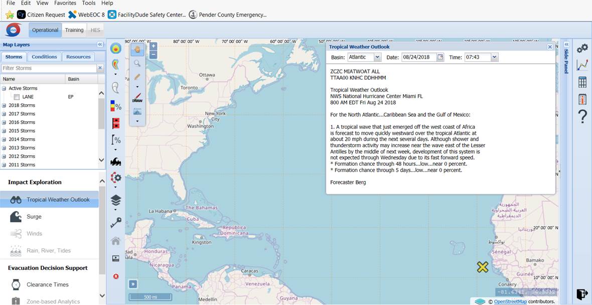
Tropical Weather Outlook
NWS National Hurricane Center Miami FL
800 AM EDT Thu Sep 6 2018
For the North Atlantic…Caribbean Sea and the Gulf of Mexico:
The National Hurricane Center is issuing advisories on Hurricane
Florence, located over the central subtropical Atlantic Ocean.
The Weather Prediction Center is issuing advisories on Tropical
Depression Gordon, located near the Mississippi-Arkansas border.
1. A broad and elongated area of low pressure is centered several
hundred miles west-southwest of the Cabo Verde Islands. The
associated shower and thunderstorm activity has changed little in
organization since yesterday, and there are no indications yet that
the system has a well-defined center of circulation. However,
environmental conditions are conducive for development, and a
tropical depression is expected to form within the next few days
while the system moves slowly westward or west-northwestward across
the tropical Atlantic Ocean.
* Formation chance through 48 hours…high…70 percent.
* Formation chance through 5 days…high…90 percent.
2. A tropical wave is forecast to move off the west coast of Africa
on Friday. Some development of this system is anticipated after
that time, and a tropical depression could form over the weekend or
early next week while the wave moves westward or west-northwestward
over the far eastern tropical Atlantic Ocean. Interests in the
Cabo Verde Islands should monitor the progress of this system
during the next several days.
* Formation chance through 48 hours…low…10 percent.
* Formation chance through 5 days…medium…50 percent.
Public Advisories on Gordon are issued by the Weather Prediction
Center under AWIPS header TCPAT2, WMO header WTNT32 KWNH, and on the
web at http://www.wpc.ncep.noaa.gov
Forecaster Berg